Challenges
Rapid urban growth leads to considerable challenges for city administrations. Thus, solutions are required to secure sustainable urban development considering financing limits of city authorities as well as quality of life and environment, calling for tools and mechanisms that can help identifying priority areas for development.
Urban development is triggered by dwelling behavior of the cities’ residents and of new migrants approaching the city, targeting the urban region as future living and working area. Influencing this behavior through appropriate urban policies and related measures allows driving urban growth towards a resource efficient direction.
Infrastructure planning can either respond to urban growth providing supply by following the demand or it can pro-actively shape urban development in a resource efficient way by providing supply directing the demand. Thus appropriate infrastructure design can serve as an instrument for “soft” urban growth management.
Our tools
The following tools have been developed by the AIT during several research projects and are used to support infrastructure planning.
Attractiveness calculator
Figure 1: Screenshot of the current user interface of the ATTRACTIVENESS CALCULATOR ® AIT
Our ATTRACTIVENESS CALCULATOR enables an estimation of the attractivity of different regions for new residential areas or business areas based on spatial data from Remote Sensing and GIS (Geographic Information System).
This is achieved by analyses using accessibility calculations to get attractivity maps. The tool is flexible in importing new input data for the calculation.
The user can combine different so called PUSH and PULL factors to estimate the overall attractivity of a region – see the figure to the left.
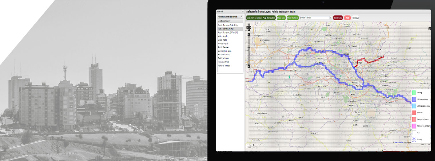
An ONLINE SKETCHING TOOL (Editor) helps collecting expert knowledge, which is currently not available as digital maps. The tool further can be used to create attractiveness maps including urban master plans respectively areas to be developed in the future.
Figure 3: ONLINE SKETCHING TOOL showing a newly planned Public Train line
Urban infrastructure development simulator (Urbanica)
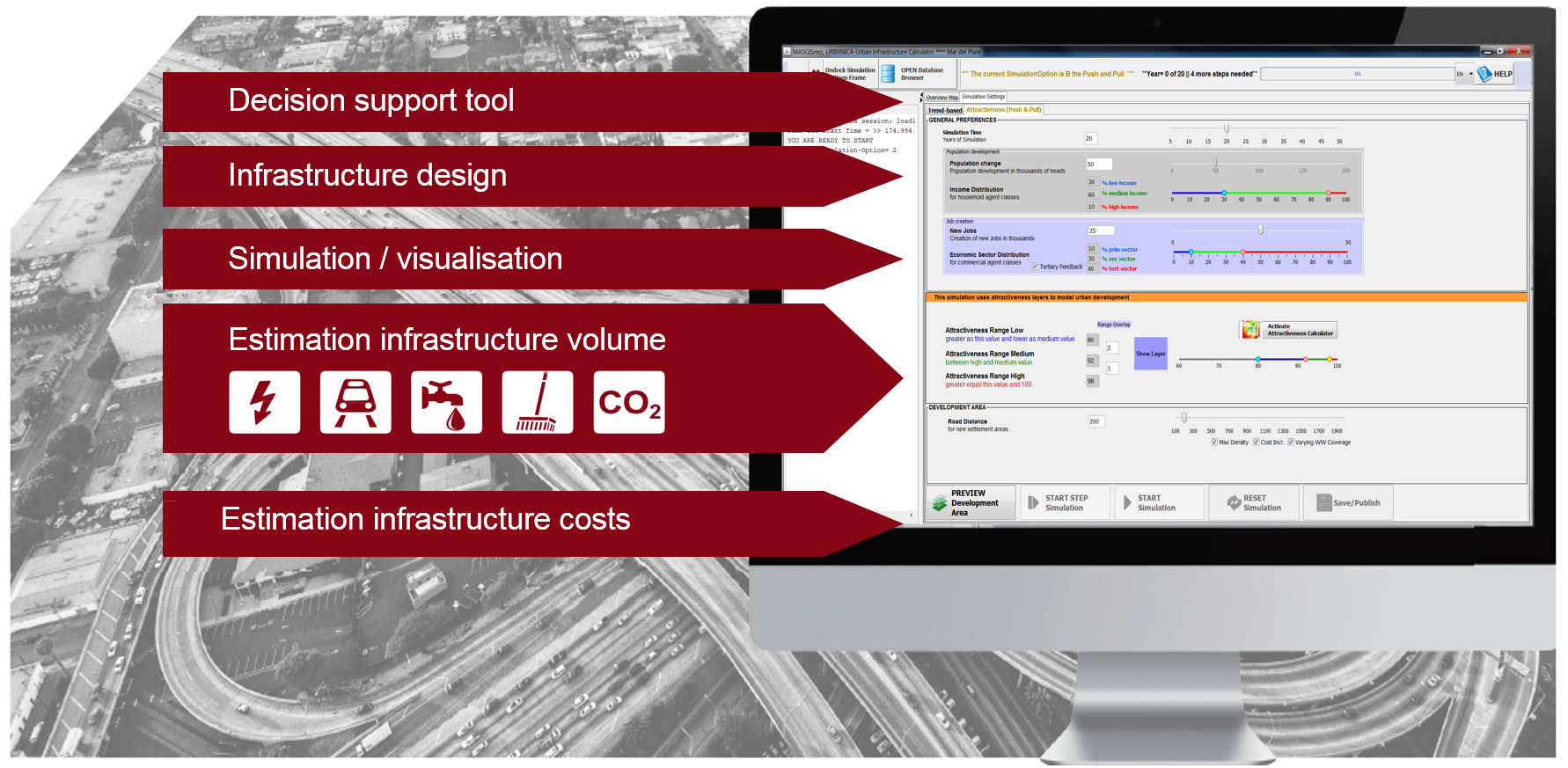
Figure 4: URBANICA USER INTERFACE
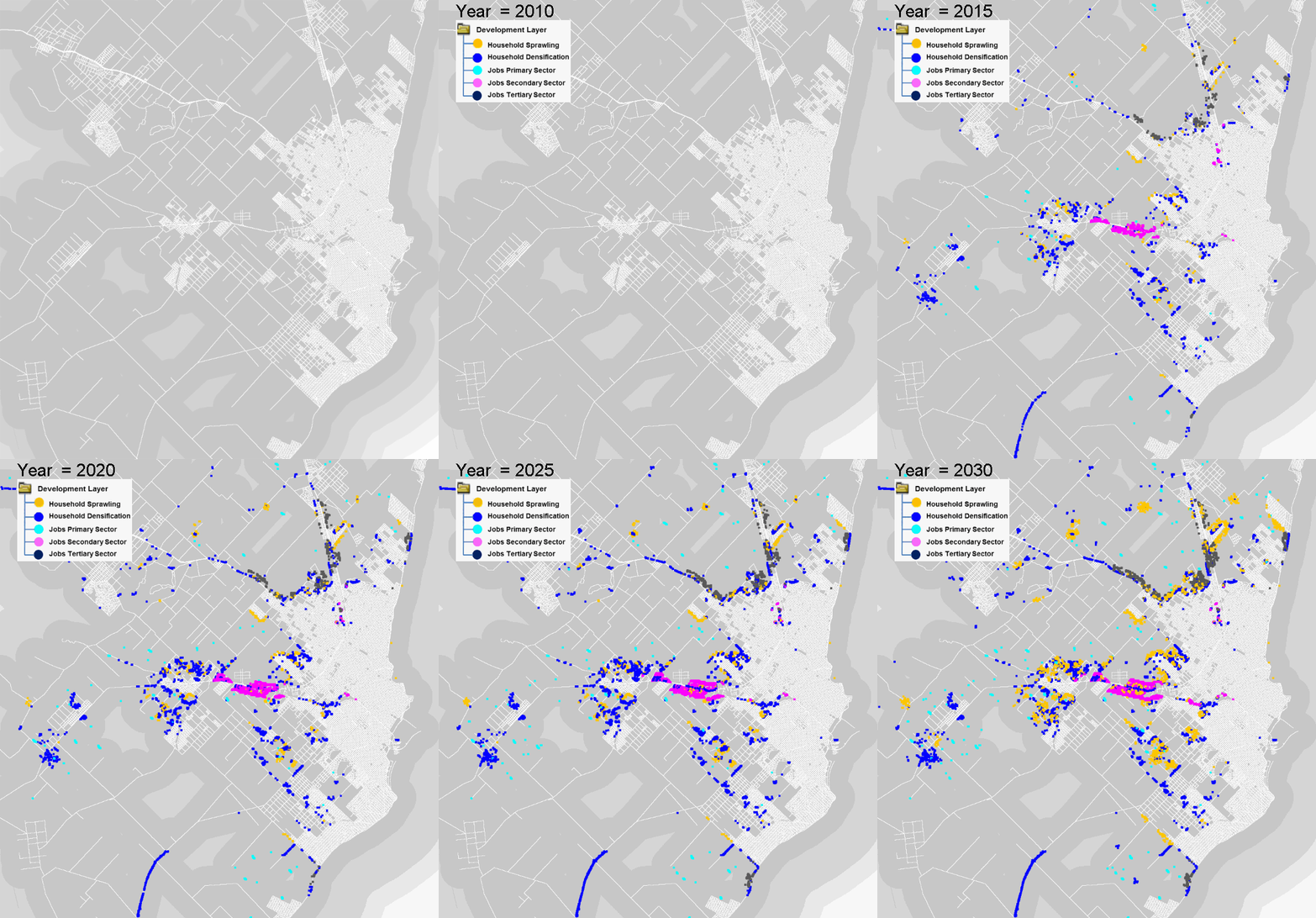
The Urban Infrastructure Development Simulator (UIDS/URBANICA) is a tool able to perform urban growth simulation and related infrastructure cost estimations, which is used to support urban planning decisions.
AIT has developed the tool for the Inter-American Development Bank (IDB). In order to support cities in a decision making process, an agent-based simulation model is used to represent the urban growth by estimating dwelling behavior of the cities’ current residents and future residents coming from urban regions outside the city. It also estimates the job creation potentials of different urban areas due to the provided infrastructure and population growth.
The urban growth simulation tool is based on input data of different spatial and temporal resolution. Data from GIS, remote sensing data as well as statistical data are used to simulate scenarios for future development paths. To support the urban planning process such kind of tools need to have great flexibility concerning their data management, e.g. in providing different possibilities to import new (e.g. more accurate) data to calculate new scenarios. UIDS/URBANICA enables urban planners to easily introduce important tacit knowledge (data) about their city to the simulation tool via an online sketching feature.
The tool can mainly be used to
- Support urban land use and transportation planning
- Simulate different scenarios
- Conduct detailed quantitative analyses of current trends and potential development pathways
- Estimate infrastructure development costs for different development scenarios
- Elaborate enhanced co-designed urban development plans
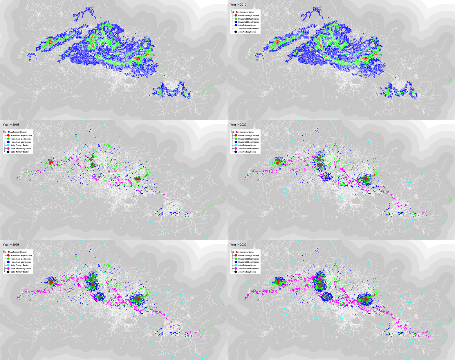
Figure 5: Animated Gifs of a region in Costa Rica (at the top) simulated with the URBAN INFRASTRUCTURE DEVELOPMENT SIMULATOR ® AIT
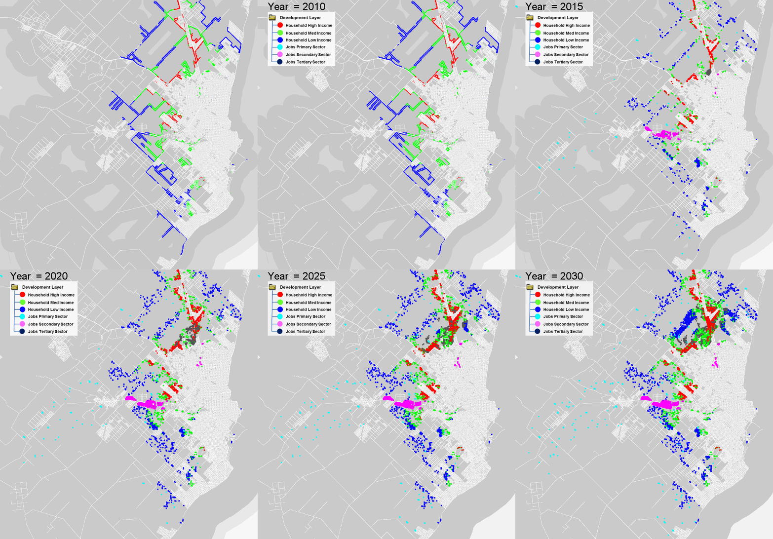
Figure 6: Animated Gif of the first scenario for a city in Argentina Mar del Plata simulated with the URBAN INFRASTRUCTURE DEVELOPMENT SIMULATOR ® AIT
Figure 7: Animated Gif of the second scenario for a city in Argentina Mar del Plata simulated with the URBAN INFRASTRUCTURE DEVELOPMENT SIMULATOR ® AIT
![[Translate to English:] Climate-Resilient Urban Pathways Symbolfoto: Das AIT ist Österreichs größte außeruniversitäre Forschungseinrichtung](/fileadmin/_processed_/f/8/csm_2013-10-01_vogelperspektive2013__c__schreinerkastler_querformatig__climate_sensitive_urban_planning_ceb9915bba.jpg)


![[Translate to English:] UD_InfraSim](/fileadmin/mc/energy/downloads/SBC/UD_InfraSim/AIT_Factsheet_Urban_Development_Simulation_NEU-1-1000x300.jpg)
![[Translate to English:] UD_InfraSim [Translate to English:] UD_InfraSim](/fileadmin/mc/energy/downloads/SBC/UD_InfraSim/AIT_Factsheet_Urban_Development_Simulation_NEU-2-1000x300.jpg)
![[Translate to English:] Push&Pull-Factors](/fileadmin/_processed_/3/2/csm_Figure_2_01dfad518b.png)
