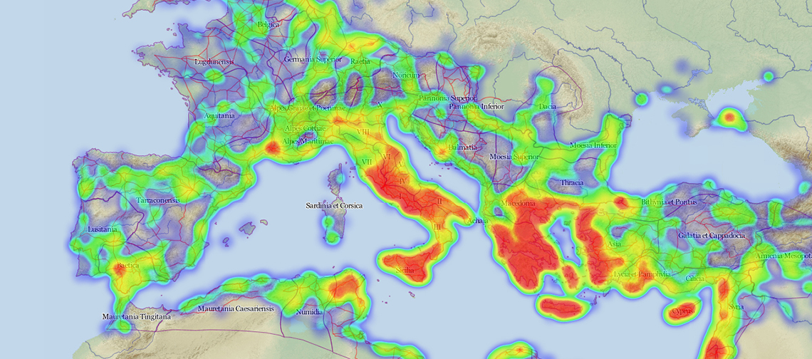
Pelagios is a community project aimed at creating an online network of digital research data in the field of classical and ancient studies. With over 30 international partners, Pelagios covers a broad range of relevant content on the Ancient World – from texts, images and inscriptions to archaeological artefacts and scientific publications through to digital indexes of individuals.
Geography is the criterion used for linking these diverse and technically heterogeneous data. The Pelagios partners use a common system to encode place names in their data, thus turning previously isolated digital datasets into a globally navigable open information network. This network, which to date includes more than 600,000 place references, allows users to find all relevant data on a specific place as well as all relevant places on a specific corpus (e.g. the “geographical footprint“ of an archaeological collection, or geographical references in a text corpus). More complex data mining methods can be employed to identify statistical patterns or similarities between places or datasets. A comparison of documents allows more specific trends to be investigated, such as the development of place names over time, or how and when exactly new place names appear in the relevant sources for the first time.
Pelagios 3 - Early Geospatial Documents
Pelagios will expand this scope both in terms of geography and time frame in the research project "Pelagios 3 - Early Geospatial Documents", which is sponsored by the Andrew W. Mellon Foundation.
The search engine will be able to identify place names and references from Latin, Greek and Arab documents up to 1492, as well as from medieval mappae mundi, Portolan charts and maps from medieval China, and create the relevant cross references to digital place name indexes. This raises significant technological challenges as well: Optical Character Recognition (OCR) – a computer-based method for the automatic recognition of text in digitised images – is inadequate for use with medieval handwritten script. The AIT experts are therefore developing new, semi-automatic methods, which employ image processing and statistical approaches to eliminate as much of the tedious manual work of transcription as possible, for example by automatically pre-selecting the positions of writing on a map and suggesting plausible transcriptions based on similar maps and other places confirmed by experts.
Facts
- Project start: September 2013
- Project duration: 2 years
- Budget: $ 494,000 (€ 363,000)
- Funding: $ 494,000 from Andrew W. Mellon Foundation
- Coordination: University of Southampton
- Partners: 12 partners from 4 countries
Image top: Overview of current content of the Pelagios database (approx 660,000 entries dating back to around 800 BC). The redder the region the more material is available on the region in the database. (Copyright: Pelagios Consortium)


