


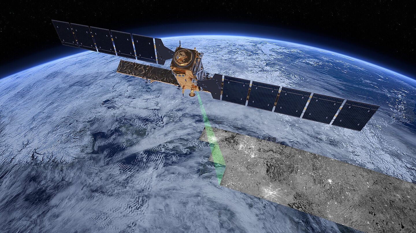
Sentinel-Satellit
Transport infrastructure is the backbone of our economy and our daily lives. AIT has been conducting research for many years into smart solutions for efficient and sustainable mobility. A key focus is on ensuring that existing structures – particularly bridges – can be used for longer, more safely and more sustainably. Extending their service life without compromising operational safety saves costs and makes an important contribution to climate protection: an average bridge contains around 2,000 tonnes of CO₂. Emissions can be significantly reduced through targeted maintenance strategies.
Condition monitoring of large infrastructure structures is currently carried out through visual inspections and structure-specific sensor technology. Regular surveys are usually only carried out on an ad hoc basis for particularly critical structures or in response to specific incidents. These methods are costly, limited in scope and time, and provide isolated, individual pieces of information.
Satellites provide data on an ongoing basis
Whilst conventional methods often provide only isolated insights, the AIT utilises state-of-the-art sensor, satellite and AI technologies that highlight changes in condition at an early stage and enable data-driven decision-making. Satellite-based structural monitoring using radar interferometry (InSAR; Interferometric Synthetic Aperture Radar) has proved particularly effective. This method allows for large-scale, continuous and non-contact monitoring of everything from individual structures to entire infrastructure networks. It does not merely observe individual measurement points, but reveals trends, deformations and other anomalies across entire sections of infrastructure. Satellite-based monitoring is minimally invasive: no installations or sensors – or only a few – are required on the structure itself.
The data is based, amongst other things, on freely available radar data from Sentinel-1 satellites, which provide extensive coverage and high temporal resolution – depending on the satellite constellation, up-to-date data is available every three to twelve days. The Sentinel-1 satellites, operated by the European Space Agency (ESA), have been observing the Earth since 2014 from an orbit approximately 700 km above the Earth’s surface.
Continuous and non-contact measurement
Using methods developed and patented by AIT – in particular virtual sensing and InSAR transformation analysis – a vertical measurement accuracy of up to 2 millimetres can be achieved under favourable conditions. This marks a paradigm shift: away from individual measurements towards network-wide, risk-based infrastructure monitoring at regional or national level. This enables scalable, network-wide screening and trend monitoring for the condition-based assessment of critical transport infrastructure and adjacent safety and energy infrastructure.
As not every structure needs to be fitted with sensors individually, the monitoring system can be deployed on a large scale and in a scalable manner. At the same time, the measurement method is technically robust: provided there is sufficient data available, clear signals can be detected as early as the warning phase of a structure’s failure – particularly in the case of long-term processes such as settlement, creep or shrinkage. In addition, depending on the available data history, the data can be analysed retrospectively as far back as 2015. This makes it possible to quantify long-term deformation trends; potentially critical areas can be identified at an early stage.
Highly accurate and practically applicable
Accuracy and practical applicability are at the forefront of ongoing development. This includes so-called ‘corner reflectors’ for improved detection of discrete points, the integral consideration of temperature-induced deformations (diurnal variations and seasonal effects), and the measurement and modelling of the structure’s temperature. Sensor fusion is used specifically to reduce errors and increase resolution – right through to the derivation of a ‘reference deformation’ as a key performance indicator for decision-making.
AIT: Research for the infrastructure of tomorrow
More than 1,600 staff members work every day at the AIT Austrian Institute of Technology on the key infrastructure issues of the future, particularly in the fields of energy, mobility, health and data. At AIT, the infrastructure of tomorrow is conceived and researched. Austria's largest research and technology organisation, AIT acts as a bridge between science and innovation, collaborating with industry and public institutions across the entire innovation chain – from the initial idea through to implementation. To further develop future-proof technologies, the AIT operates Austria’s most advanced research infrastructure, with specialised laboratories for energy, mobility, urban planning, digital security, food security and much more. AIT research makes a difference and creates solutions – for industry, society and, ultimately, for us all.

Mag. Florian Hainz, BA
Marketing and Communications / Center for Transport Technologies- +43 50550-4518
- +43 50550-6599
- florian.hainz(at)ait.ac.at