


How can reliable positioning be achieved in cities where satellite signals are disrupted or completely blocked by buildings? This is the challenge addressed by the egeniouss research project, in which the AIT Austrian Institute of Technology collaborates with international partners. The goal is to develop an end-to-end navigation system that intelligently combines multiple sensor sources to enable precise and robust localisation—even under difficult conditions.
egeniouss is designed as an application-independent service, making it suitable for a wide range of location-based and positioning-critical applications. Its performance is demonstrated through three complementary use cases:
- smartphone-based surveying
- drone delivery beyond visual line of sight in urban areas
- bicycle navigation in dense city environments
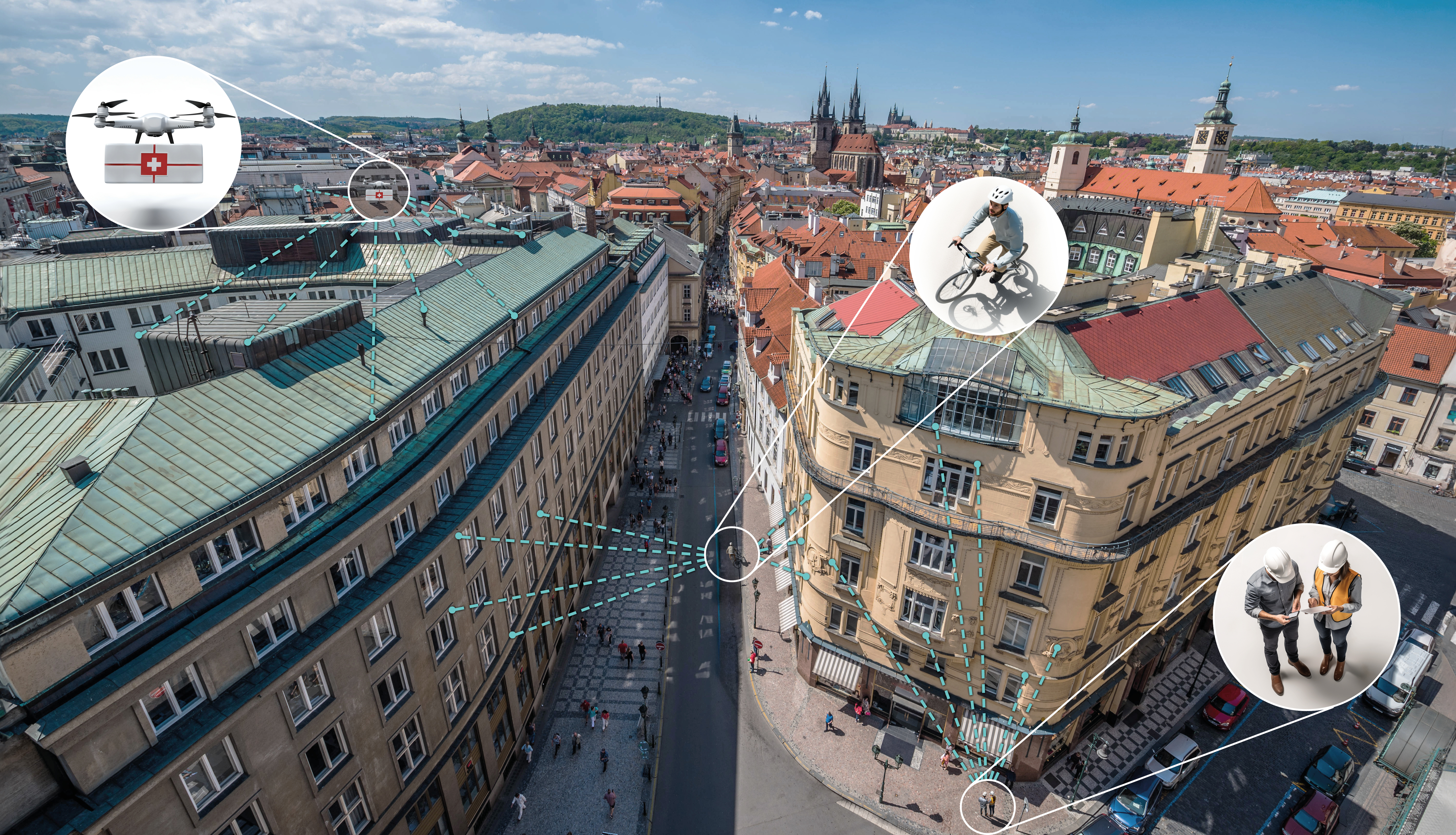
Six presentations, six different angles – one goal: achieving reliable urban navigation
At its core, egeniouss extends conventional satellite navigation by combining sensor fusion, visual perception, and integrity mechanisms. The result is a navigation framework that enables reliable positioning even under limited GNSS conditions, opening up new possibilities for applications in mobility, robotics, and digital infrastructure.
egeniouss is presented from multiple perspectives in a series of scientific contributions at the European Navigation Conference (ENC), which is widely acknowledged as the most important annual event bringing together the positioning, navigation and timing community in Europe. ENC2026 will be held 28-30 April 2026 in Vienna, Austria.
1) egeniouss: An End-To-End Multi-Sensor Navigation Framework for Complex Urban Environments
Alexander Kern, Markus Gerke, Yasmin Loeper – Technische Universität Braunschweig; Francesco Vultaggio, Matthias Schörghuber, Phillipp Fanta-Jende – AIT Austrian Institute of Technology; Johannes Hecher, Lucija Aleksic – SoftwareONE Holding AG; Marta Blázquez, Arnau Valls, Ismael Colomina – GeoNumerics S.L.
This opening egeniouss presentation provides an overview of the complete navigation system, which combines GNSS, inertial sensors, visual odometry and visual localisation into one scalable framework. It introduces how egeniouss delivers robust, high-accuracy positioning in complex urban environments where conventional satellite navigation struggles.
2) Visual Localisation as a Building Block for Resilient Multi-Sensor Navigation Using Aerial, Terrestrial and Hybrid Meshes
Francesco Vultaggio, Phillipp Fanta-Jende – AIT Austrian Institute of Technology; Alexander Kern, Markus Gerke – Technische Universität Braunschweig; Johannes Hecher, Lucija Aleksic – SoftwareONE Holding AG; Peter Joosten – Cyclomedia
As part of the egeniouss system, this contribution presents the visual localisation module that provides absolute 6-DoF positioning when GNSS is unreliable. Using aerial, street-level and hybrid 3D meshes, it analyses how different map sources and operating modes affect localisation accuracy, robustness and runtime.
3) Aiding HAS with Inertial and Visual Measurements for Navigation on Low-cost Devices
Marta Blázquez, Marina Berbel, Ignasi Delgado, Arnau Valls, Ismael Colomina – GeoNumerics S.L.; Phillipp Fanta-Jende, Francesco Vultaggio, Matthias Schörghuber – AIT Austrian Institute of Technology; Alexander Kern – Technische Universität Braunschweig
This egeniouss contribution investigates how Galileo HAS can be strengthened on smartphones and other low-cost devices through inertial sensors, visual odometry and visual localisation. It demonstrates how combining satellite, motion and camera data improves navigation performance in dynamic urban environments where GNSS alone is limited.
4) Accurate UAV Positioning in Urban Environments with Degraded or Denied GNSS using egeniouss
Joan Altimira – Catuav; Alexander Kern – Technische Universität Braunschweig; Johannes Hecher – SoftwareONE Holding AG
This egeniouss contribution discusses how the system can support drone missions such as delivery in dense urban areas. By combining GNSS, HAS, inertial sensors, visual odometry and visual localisation, it enables reliable navigation in degraded or fully denied GNSS conditions, with built-in confidence monitoring and fallback strategies for safe operations.
5) Smartphone-Based Decimetre-Level Positioning for Urban Navigation and Surveying
Berit Mohr – OPENGIS.ch; Achim Hennecke – beemo
This egeniouss contribution evaluates how the system’s high-accuracy positioning can be integrated into everyday smartphone applications. Using urban surveying and bicycle navigation as examples, it demonstrates the practical benefits and usability of egeniouss positioning in challenging city environments.
6) ZPose Verification Based on Visual Localisation Using CityGML Models
Yasmin Loeper, Markus Gerke – Technische Universität Braunschweig; Phillipp Fanta-Jende – AIT Austrian Institute of Technology
This egeniouss contribution adds an extra safety layer to the navigation framework by using CityGML city models to independently verify estimated positions. It shows how lightweight 3D building data can support pose validation in urban environments, increasing robustness against GNSS errors and other navigation failures.
More on the EU funded projekt egeniouss
www.egeniouss.eu
linkedin.com/company/egeniouss/
European Navigation Conference (ENC)
www.linkedin.com/company/europeannavigationconference/